


Hema Outback Queensland Map - Camooweal to Stanthorpe (5th E
Make 4 payments of $3.99 over 8 weeks with

In Stock - In Stock at Supplier - Item Ships in 2-5 business days
Special Order Item - Terms and Conditions apply.
Need it fast? Contact us to confirm lead times.
Pickup currently unavailable.




Plan the perfect Tassie lap
Tasmania packs wild coast, mountains, wilderness and great food into a small island. This waterproof Hema map shows the whole state at 1:500,000, with detailed maps of the areas most visitors want to explore.

Hema Maps has been mapping Australia since 1983. Its maps are field checked by the Hema Map Patrol, the team that drives Australia's roads and tracks to check the mapping first-hand.
Every road, camp and park
The fully updated and indexed main map shows national parks, fuel locations, campsites and caravan parks, with clear symbols for every stop. The cover notes it also incorporates the what3words locator system.


Four close-up maps
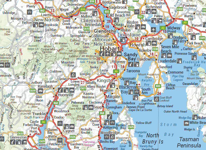
Detailed maps zoom in on the places you will spend the most time: Hobart and region, Freycinet, the Southwest and the West Coast around Zeehan and Queenstown.
Ideas on the back
The reverse side sums up the key things to see and do, region by region, with a table of national parks and reserves and their facilities, and a complete list of visitor information centres.

Yes. The cover states it is printed on waterproof paper.
This is the 4th edition (ISBN 9321438002208), published in 2021.
Yes. There is a Hobart and region map at 1:250,000 showing petrol stations, information centres and rest stops.
Yes. A 1:250,000 map of the Zeehan and Queenstown area includes Lake St Clair and Franklin-Gordon Rivers National Park.
It is a state touring map. For more detail on tracks, walks and camps, add the Hema Tasmania Atlas & Guide.


| Brand | Hema Maps |
| Title | Tasmania State Map |
| Series | State Map |
| Edition | 4th |
| ISBN | 9321438002208 |
| Main map scale | 1:500,000 |
| Area maps | Zeehan & Queenstown (1:250,000), Freycinet NP (1:125,000), Southwest NP (1:200,000), Hobart & Region (1:250,000) |
| Publication date | February 2021 |
| Paper | Waterproof paper |
| Folded size (W x H x D) | 140 x 250 x 3 mm |
| Flat size (W x H) | 700 x 1000 mm |
| Weight | 68 g |
| SKU | 9321438002208 |
| Barcode # | 9321438002208 |
| Brand | Hema Maps |
| Shipping Weight | 0.0900kg |
| Shipping Width | 0.140m |
| Shipping Height | 0.005m |
| Shipping Length | 0.250m |
Hema Maps has been mapping Australia since 1983, with touring and 4WD maps built from tracks its own teams have driven and GPS-surveyed. Hema Maps began in 1983, when Henry and Margaret Boegheim started laminating marine charts from their family home in South East Queensland, naming the business aft...
Find Out More
Make 4 payments of $3.99 over 8 weeks with

Make 4 payments of $9.99 over 8 weeks with

Make 4 payments of $2.99 over 8 weeks with
This item is currently on back order and may require additional processing time.
This is a non-stocked item and may require additional processing time. Please click here for more information.