


Hema K'gari (Fraser Island) & the Brisbane Islands Atlas & G
Make 4 payments of $12.49 over 8 weeks with

In Stock - In Stock at Supplier - Item Ships in 2-5 business days
Special Order Item - Terms and Conditions apply.
Need it fast? Contact us to confirm lead times.
Pickup currently unavailable.


Explore the High Country's best 4WD tracks
This is Hema's guidebook and atlas for the Victorian High Country in one. It pairs topographic atlas mapping with the Top 30 4WD trips, written by off-road legends Ron and Viv Moon, so you can plan the trip, then follow it on the track.

Hema Maps has been mapping Australia since 1983, and its Map Patrol team drives the roads and tracks to field-check the mapping first-hand. The cover carries the Map Patrol 'field checked' stamp.
Every trip, start to finish
Trips are grouped by area, and each one comes with gradings, distances, travel information and drive coverage from start to finish. You also get campsites, facilities and the best time of year to go.


Topo mapping at 1:150,000
40 atlas pages cover the High Country at a large 1:150,000 scale in Hema's newer cartographic style. Tracks, huts, camping areas, contours and national park boundaries are all on the page.
More than a map book
An introduction to the region, trip planning advice and what to see and do sit alongside detailed touring sections on the Great Alpine Road, Alpine National Park, and the Snowy River and Baw Baw national parks.

The Top 30 4WD trips were written by off-road authors Ron and Viv Moon.
Iconic High Country tracks such as Wonnangatta (Zeka Spur), Billy Goat Bluff, the Ingeegoodbee Track, Mount Pinnibar and the Blue Rag Range Track, grouped by area.
The atlas section has 40 pages at 1:150,000. For more detail on the track, pair it with the Hema High Country map pack below.
Many High Country tracks have seasonal closures. The guide lists the best time of year for each trip; always check current closures with Parks Victoria before you go.
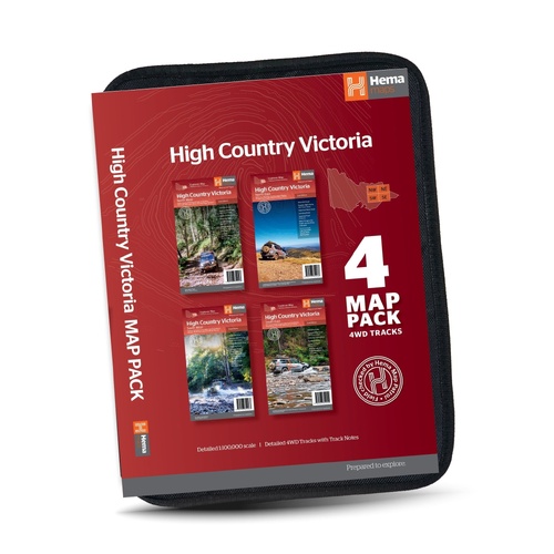
Four Hema High Country maps at 1:100,000 for more track detail.
$69.95 · View


| Brand | Hema Maps |
| Title | The Victorian High Country Atlas & Guide |
| Edition | 3rd |
| Publication date | April 2017 |
| ISBN | 9781876413149 |
| Pages | 208 |
| Atlas | 40 pages at 1:150,000 |
| 4WD trips | Top 30, by Ron and Viv Moon |
| Binding | Spiral bound |
| Size (W x H) | 215 x 297 mm |
| Weight | 955 g |
| SKU | 9781876413149 |
| Barcode # | 9781876413149 |
| Brand | Hema Maps |
| Shipping Weight | 0.9550kg |
Hema Maps has been mapping Australia since 1983, with touring and 4WD maps built from tracks its own teams have driven and GPS-surveyed. Hema Maps began in 1983, when Henry and Margaret Boegheim started laminating marine charts from their family home in South East Queensland, naming the business aft...
Find Out More
Make 4 payments of $12.49 over 8 weeks with

Make 4 payments of $7.49 over 8 weeks with

This item is currently on back order and may require additional processing time.
This is a non-stocked item and may require additional processing time. Please click here for more information.