


Hema K'gari (Fraser Island) & the Brisbane Islands Atlas & G
Make 4 payments of $12.49 over 8 weeks with

In Stock - In Stock at Supplier - Item Ships in 2-5 business days
Special Order Item - Terms and Conditions apply.
Need it fast? Contact us to confirm lead times.
Pickup currently unavailable.


Big, clear maps for the whole country
Find small print hard to read on the move? The Easy Read is Hema's Road & 4WD Atlas at its largest. The 292 x 397 mm pages give you bigger, clearer mapping, whether you are planning at the kitchen table or checking the next turn from the passenger seat.

Hema Maps has been mapping Australia since 1983, and its Map Patrol team drives the tracks to field-check the mapping. The Road & 4WD Atlas is Hema's best-selling Australian road atlas.
Road maps plus the big 4WD destinations
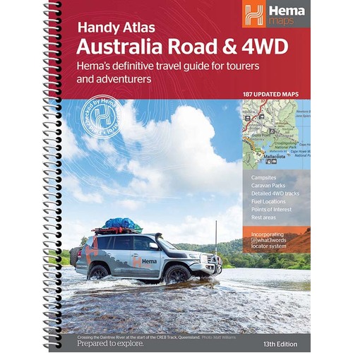
This 13th edition has 187 updated map pages in a clean, easy-to-read cartographic style. As well as road coverage for every state and territory, it includes maps for Australia's biggest 4WD and touring destinations, and extra maps with more detail for the busy coastal strips.


Find the camp, the fuel and the turn-off
Caravan parks, camping and rest areas, fuel, visitor information centres and points of interest are pinpointed right on the maps. Map pages carry a grid reference, and the atlas incorporates the what3words locator system.
Tools for planning at home and on the road
A distance grid, national park guide, list of accredited visitor information centres and a complete index help you plan the route and find any town fast.

This is the 13th edition (ISBN 9781922668028), with 187 updated maps in a new cartographic style.
The pages are 292 x 397 mm, the largest of Hema's Road & 4WD atlases. It is spiral bound and weighs about 1.95 kg, so it suits the caravan, the passenger seat or the planning table.
Yes. It shows detailed 4WD tracks, campsites, caravan parks, rest areas, 24-hour fuel and points of interest, plus dedicated maps for the major 4WD destinations.
The Handy (185 x 248 mm), Touring (215 x 297 mm), Spiral Bound (252 x 345 mm) and Easy Read (292 x 397 mm) atlases share the same Hema mapping. They differ in page size, so choose the one that suits your vehicle and how easily you like to read the print.

The same mapping in a compact 185 x 248 mm size for the glovebox.
$29.95 · View

Over 5,500 places to camp across Australia, from caravan parks to bush camps.
$64.95 · View

| Brand | Hema Maps |
| Title | Australia Road & 4WD Easy Read Atlas |
| Edition | 13th |
| ISBN | 9781922668028 |
| Maps | 187 updated maps |
| Coverage | All of Australia |
| Binding | Spiral bound |
| Locator system | what3words |
| Page size (W x H) | 292 x 397 mm |
| Weight | 1.95 kg |
| SKU | 9781922668028 |
| Barcode # | 9781922668028 |
| Brand | Hema Maps |
| Shipping Weight | 1.9500kg |
Hema Maps has been mapping Australia since 1983, with touring and 4WD maps built from tracks its own teams have driven and GPS-surveyed. Hema Maps began in 1983, when Henry and Margaret Boegheim started laminating marine charts from their family home in South East Queensland, naming the business aft...
Find Out More
Make 4 payments of $12.49 over 8 weeks with

Make 4 payments of $7.49 over 8 weeks with

This item is currently on back order and may require additional processing time.
This is a non-stocked item and may require additional processing time. Please click here for more information.